33 days away from the world
ANTARCTICA 2020

INTRODUCTION
Discover the expedition
ANTARCTICA 2020
January 2020
Ushuaia, Tierra Del Fuego
There are only a few cities on Earth that immediately evoke a sense of adventure, remoteness, and wilderness, and Ushuaia is certainly one of them. In my experience, Ushuaia has been a place for brief respites, hurried pit stops sandwiched between two cruises—too brief to explore beyond avenue St Martin. I know all the good internet cafés, the best supermarkets to avoid crowds, and not much more. However, this year, I made the decision to truly delve into the "authentic" Ushuaia. I rented an Airbnb for eight days before embarking on one of the most extraordinary polar cruises available: a semi-circumnavigation of Antarctica from Ushuaia to New Zealand, venturing through the remarkable Ross Sea.
In January, Ushuaia hits its peak tourist season. It's the height of summer, but don't expect beach weather; after all, it is the "fin del mundo" (end of the world). Over eight days of exploring the town and its surroundings, I experienced every type of weather imaginable—from hail, rain, and snow to moments of calm and sunshine. However, finding times without the notorious wind of Patagonia proved to be a challenge.
The town, whose name translates to "at the back of the bay/cove," stretches SW-NE between the Beagle Canal and the Martial mountain range to the North. It doesn't take long to find yourself immersed in the Nothofagus tree forest or atop a windswept mountain. After eight days of hiking, working on my lectures, and reconnecting with some wonderful friends fortunate enough to call Ushuaia home, the call of Antarctica became irresistible.
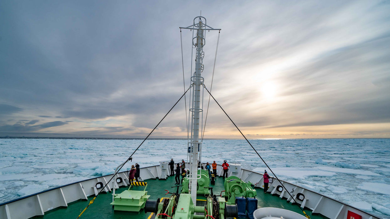
The long traverse commenced. Bellingshausen Sea, Amundsen Sea... many days at sea awaited us before reaching our primary destination, the incredible Ross Sea. Sea days were far from dull. There was always plenty to do on the ship, from lectures and equipment preparation to training, keeping us occupied. Surprisingly, the excellent weather stuck with us, and I didn't experience seasickness even once on this cruise—a remarkable first for me! I made an effort to spend most of my time on the outer decks, observing enormous tabular icebergs passing by and witnessing the ever-changing sky. It was an incredible feeling to know that we were the only ones there. While numerous ships explored every inch of the Peninsula, we stood as the sole witnesses to this breathtaking natural spectacle.
Approaching the Ross Sea presented its challenges. A dense band of sea ice obstructed our path to the Ross Sea, and we found ourselves entangled in it. We hoped to find a small opening free of ice to avoid a substantial detour that would have added another 4-5 days of sailing—a prospect none of us relished after spending 9 days on a ship without disembarking. We were all eagerly anticipating catching that lead!
Despite our best efforts, we became firmly stuck in the sea ice. The situation prompted our captain to deploy the large drone (heli) to gain an overview and map out the location of the lead. Although we had satellite images, the weak internet connection only provided images a few days old. I was fortunate to be part of that flight and gained insights into "mapping sea ice for a ship" while flying at high speeds. The strategy worked, and a few hours later, our troubles were far behind us.
ROSS SEA
Until last year, I honestly had no idea that some cruise ships would take passengers all the way to the Ross Sea. But there I finally was. The day we arrived at the Ross Sea was quite extraordinary. With the sea ice behind us, we found ourselves surrounded by enormous tabular icebergs under a dark, menacing sky. The entire atmosphere was eerie. This place was an entirely different ball game.
The Ross Sea was the primary goal of our cruise, the place where we aimed to spend most of our time exploring. We had so many incredible locations to visit—places I had been dreaming of for a long time, locations I had read about in books, and had been captivated by in geography books. From that point on, it felt like being the character of one of my wildest dreams.
The first place we stopped at completely blew my mind. We aimed for one of the most famous locations in the area, forever associated with the exploration of the South Pole: the Bay of Whales. First named by Shackleton during his Nimrod expedition, it was primarily used by Amundsen to access the Ross Ice Shelf and establish his base to prepare for the South Pole. The Bay of Whales is a natural opening in the shelf, a perfect harbor.
I woke up just past midnight, encountered a couple of our most passionate passengers already on the outer decks. The light was incredible. The Bay of Whales was indeed full of whales that night. On the horizon, we could see a thin golden line that grew bigger and bigger. At about 2 AM, our expedition leader gently woke our passengers up to announce that we would arrive soon. In front of us, a giant white wall stood in our way: the Ross Ice Shelf. The moment was magical. We reached 78°S, the southernmost point I had ever reached, which is, amusingly enough, the same latitude as Longyearbyen, except in the southern hemisphere.
For me, this was already the highlight of the trip, the highlight of the year, probably one of the highlights of my entire life! Knowing that climate change is deeply affecting these fragile ice shelves, no matter how big they are, made it all very bittersweet. The Ross Ice Shelf seems okay for now; let's hope it stays in place for many centuries to come.
After a quick nap, we spent the rest of the day sailing along the shelf, dreaming of Amundsen, his men, and his dogs leaving Framheim for the unknown. Speaking of explorers, we aimed for another unbelievable adventure the next day. After hoping to do a sightseeing flight over the shelf or even a drop-off but had to cancel because of the Antarctic winds, we decided to pay a visit to Scott's hut at Cape Evans!
ONBOARD MV ORTELIUS
On January 13th, I could finally board the MV Ortelius, my home for the next 33 days. Embarkation days are always quite hectic. After a brief meeting with my new colleagues, we were given 2 hours to buy our last provisions and return to greet our passengers. However, 2 hours quickly turned into 5 minutes, as truckloads of food had to be manually loaded onto the ship. It turned out to be a good team workout and an excellent way to get to know our colleagues from the galley, hotel, and navigation.
MV Ortelius is one year younger than me, built in 1989 in Poland exclusively for polar expedition cruising. Ice-strengthened, the ship voyages to both the Arctic and Antarctica. Acquired by Oceanwide in 2011, it has been sailing the world ever since. Many of my friends have worked on it as polar guides, and now it was my turn to join as their "glaciologist in residence" for one cruise only. But not just any cruise—33 days along the peninsula, the Amundsen Sea, the Bellingshausen Sea, and finally the Ross Sea.
The team I joined was by far the most experienced group I have ever been fortunate enough to join. Many of them had already overwintered several times in Antarctica, completed the Ross Sea cruise numerous times, and were all absolute polar veterans. I was set to learn a lot from them.
After a couple of days at sea and the Drake Passage behind us, we finally reached our first site—the incredible Lemaire Channel and Vernadsky Station. The day was beautiful, and two of our guests even got married on the ship while crossing the Lemaire; it all felt truly magical.
PETER THE 1st ISLAND
This expedition cruise will take us on a journey of 6000 miles over 33 days, covering a considerable distance. Fortunately, after our fantastic stop on the peninsula, another extraordinary one awaits us:
Peter the 1st Island!
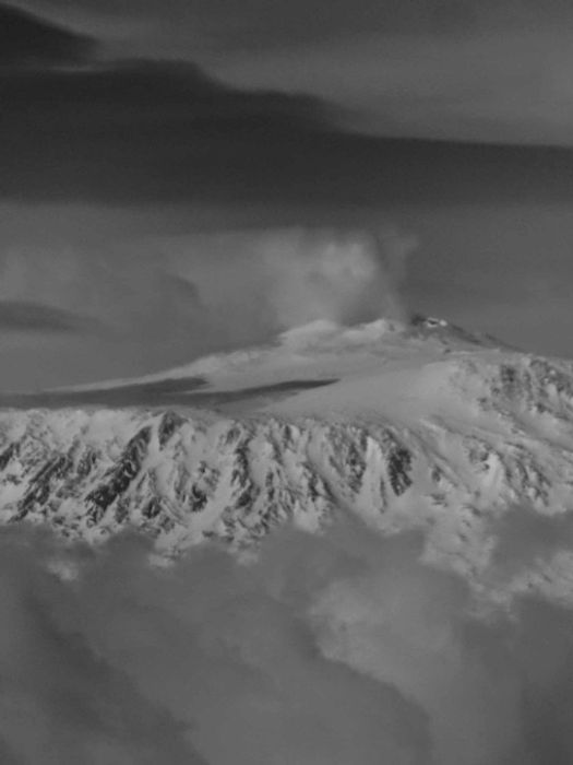
More people have ventured into space than have managed to set foot on Peter the 1st. This volcanic island, part of the Norwegian claims in Antarctica, is situated about 450 km west of continental Antarctica and is almost entirely covered by ice. Its challenging topography explains the sparse number of visitors; the island is encircled by ice and vertical cliffs. Nevertheless, we'll give it our best shot—bringing our ship as close to the island as possible. Who knows, we might deploy our zodiacs or even our big toys: the three helicopters we have on board?
The island emerged late one afternoon. Battling a fierce westward wind, we found shelter behind the island on the downwind side. After a thorough assessment of the situation, we decided to attempt sightseeing flights for all our guests, running through the night. The sunset was breathtaking, whales surrounded us, making it a truly stunning evening.
CAPE EVANS
Scott was Amundsen's big rival in the race to the South Pole. He started his exploration not from the ice shelf like Amundsen, but from land, a place they called Cape Evans, at the entrance of Erebus Bay. The hut was built in 1910, hosting the headquarters of Scott's expedition. It is now a "Historic Site or Monument," preserved and stabilized by the Antarctic Heritage Trust.
Visiting Cape Evans is a step back in time. Everything in the cabin has been stabilized and put back the way it was during Scott's time. It felt so real—the smells, the atmosphere—it's like the men are still around, working with the dogs, the horses, fixing the roof, and you are just exploring the cabin. Only a few people are allowed in the cabin at once. With the rest of the expedition team, we were lucky to get into the hut before our passengers and spent a handful of minutes there by ourselves.
THE DRY VALLEYS
As if this cruise was not crazy enough, we decided to attempt a trip to the Dry Valleys of Antarctica. You know—the driest place on the driest continent, the largest ice-free place on the continent. The place I have been dreaming of visiting for as long as I can remember. We woke up to an amazingly beautiful morning, so calm, surrounded by icebergs and sea ice in McMurdo Sound. We tried to get as close to the Dry Valleys as possible, but the fast ice became too thick. My heart exploded when I got called to join the recce trip to Canada Glacier. The flight was absolutely mind-blowing. We rapidly entered Taylor Valley, after calling Mc Radio (from the US station of McMurdo) to inform them of our plans.
That's when I noticed there was another helicopter right in front of us, a few hundred meters away. I wish Mc Radio could have informed us of this big hazard, but we had to find this out on our own! There was indeed another helicopter flying back and forth for the scientists working in the valley. Seventeen minutes later, we were landing by Canada Glacier, about 13 km into Taylor Valley. The glacier was huge with vertical cliffs all around and a very distinct pattern that makes it a great analogue for glaciers on Mars, characterized by strong ablation and dust deposition.
As soon as the helicopter landed, we took all the equipment out—radios, tents. We had to be ready for anything, even being stranded there in case the weather would have turned for the worse. But another miracle happened; I was invited to fly again (!) this time to go even further into Taylor Valley, all the way to Taylor Glacier and its blood falls!!! How mad is that. Let me show you some pictures first, so you get a sense of the craziness.
The mystery of the blood falls of Taylor Glacier has puzzled scientists for a very long time. Finally, we know where this red-brown color is coming from. It is obviously not blood, but brine coming from the base of the glacier. The water flows at negative temperatures because of its high salt content, and the color comes from iron oxidized when it comes in contact with air. Just total science porn, as my friends would say.
This flight was a reconnaissance flight for future trips. Perhaps in the next couple of years, it will be possible to fly passengers over Taylor Glacier and show them how unique this place is. We landed back next to Canada Glacier and exploded with joy and happiness. This was probably one of the very best days of my life.
For the rest of the day, I was happy to do the least interesting activity possible and help our team bring all our passengers on land. It is quite a tricky ballet, having 3 helicopters flying around, dropping and picking up passengers every 5 minutes. I helped open and close the doors of the helicopters, safely shuttling passengers to and from the "heliport." What an amazing day that was. The next day started with pretty difficult conditions.
We were still in McMurdo Sound, but this time the weather was proper murky. Really thick fog, sea ice everywhere, and crazy wind. Not easy to make decisions when the conditions are so difficult, but our expedition leader had a great idea: go and check out McTown or McMurdo station! We were not invited to visit the station, but just seeing it from the ship was really special. We used the channel cut in the sea ice by the US icebreaker and saw so much Nilas ice, the first step in the formation of sea ice.
CAPE BIRD
But it was so windy. Everywhere we tried to go, the wind was too much for our zodiacs or our helicopters. Except... in a very small location around a place called Cape Bird! We arrived there in the late afternoon, the sun was shining, the cape was covered in penguins, what's not to like! We took all our passengers on land and let them have a good wander, felt so good to stretch our legs and be surrounded by penguins. About 30 of our passengers decided the conditions were optimal for a little swim!
CAPE HALLETT
The 2nd of February was a sea ice day. We moved from one patch of sea ice to another, but the sights were absolutely amazing. So many emperor penguins, so many orcas and icebergs, one of our very best sea days. We continued our slow migration north, and reached thick ice close to Cape Hallett.
After a careful assessment of the conditions, we decided to launch a sightseeing operation with our helicopters. Once again, I joined the recce trip, which was oh so amazing, and spent the rest of the day trying to find the elusive Ross seal (that we never saw) on the sea ice. We had two days left in the Ross Sea. And one site we really wanted to tick off our list. The most difficult, the most technical: Cape Adare. This prominent cape on the northern tip of the Adare peninsula is super exposed to currents, winds, drifting sea ice. But the weather gods were back on our side for a great finish in the Ross Sea, and the forecast was perfect.
CAPE ADARE
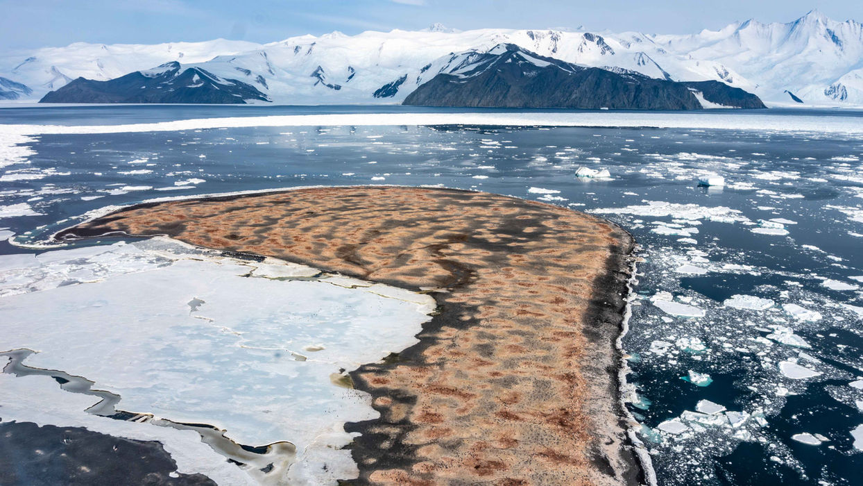
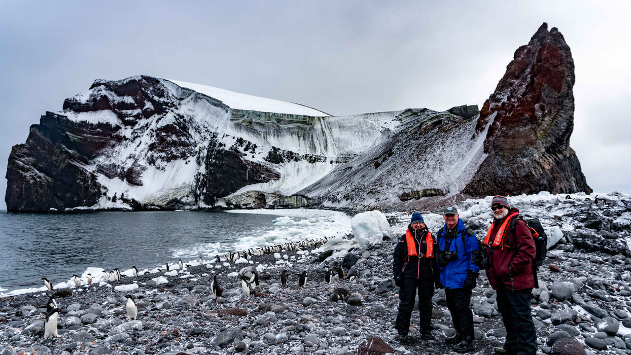
This place is the largest Adélie penguin rookery in the world, and the first place where a building was erected in Antarctica. So major keys at Cape Adare. We were ready for anything. And we got the warmest conditions we could have ever imagined. On the same day, the warmest temperature ever recorded on the peninsula, we were all melting in the Ross Sea. It is pretty mind-boggling to be around hundreds of thousands of penguins. We were on a mission to find careful paths to the Borchgrevink hut, and we made it just in time before our passengers got dropped off. What an amazing day that was.
So so happy we could land there. The hut was built in 1899 and was home to the first party to overwinter on the Antarctic continent.
We were all so heartbroken to leave the Ross Sea after that. But just as our ship was heading North, a pod of whales came to bid us goodbye. The way back to New Zealand was going to take us 4 to 5 full days of sailing. We were a little bit ahead of time and made the most of the migration north by visiting as many islands as we could. First on our list: the elusive Balleny Islands.
THE BALLENY ISLANDS
The Balleny's are only a day away. We may/may not even see them, may or may not be able to approach them. So the expectations are pretty low. These small inhabited islands are exposed to strong winds, crazy currents, and drifting sea ice. Only so few people have managed to actually step foot on them.
We aimed for Sturge and Buckle islands. That way, we were onto a very special mission with Steve, our biologist. Steve had been collecting penguin bones at different locations throughout the voyage. Analyzing the bones provides information on the diet of the penguins and can help reconstruct climate over hundreds or even thousands of years if such old bones can be found.
The goal that day was to do the impossible: land on the islands and collect samples. We were a small party, Steve and I, and two lucky passengers that had won a raffle and an auction. The conditions were better than expected. There was little sea ice in the area, not too much wind, and we attempted to take all our guests out for a zodiac cruise in two rounds. The first round went well and helped us monitor the conditions. We felt confident to land and be picked up during the second round.
Less than 100 people have landed on these islands, and we added 4 more to that list! We spent about 1.5 hours, running around, trying hard to find bones that looked old.
Discover the other expeditions
NEW ZEALAND SUB-ANTARCTIC ISLANDS
The North was calling, and we resumed our sailing towards New Zealand. It took us another few days to reach Campbell Island, a beautiful NZ sub-Antarctic island at 52°S. We were not allowed to step on the island but had the best time taking our zodiacs out and exploring Beeman Cove. It felt so good to see all that green around us! Our highlight was the "loneliest tree in the world," a Sitka Spruce planted there more than 100 years ago.
The next islands we visited were the Snares, just one day away from our final destination. It was the best way to conclude this extraordinary voyage. We had the most beautiful zodiac cruise, spent long hours exploring every crack and cave we could find, and took thousands of pictures of the Snares crested penguins and the albatrosses doing their courtship rituals.
This marks the end of this semi-circumnavigation of Antarctica! Time to plan some fieldwork in the same areas we visited :)


